BECOME will use a legacy dataset and new remote sensing techniques to analyze changing trends in over 100 BRs worldwide whose management approaches have been followed for over 10 years.
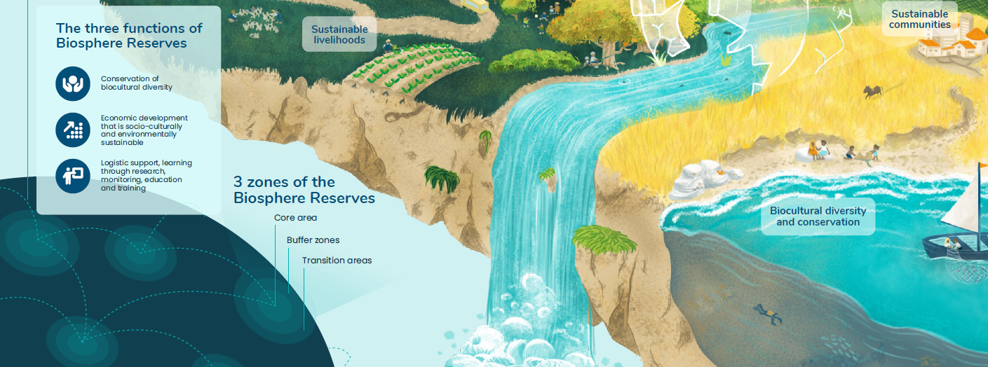
WP1 will integrate existing longitudinal data across various data streams to understand how BR management approaches result in different trade-offs between goals and different zonation effectiveness at a global scale. In practice, BRs articulate the relationship between formally protected areas (“core areas”) and the ‘working matrix’ (“buffer zones” and “transition areas”) through a spatial zonation structure of graduated land-use intensities in support of overall ecosystem sustainability and biodiversity conservation. However, the long-term effectiveness of different approaches to the zonation system on conservation objectives is not well understood and shedding light on this will be the core objective of this work.